
Features 紀北町防災ナビ
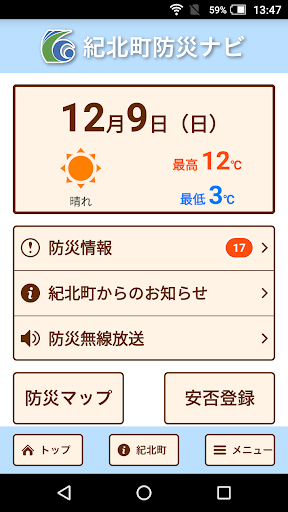
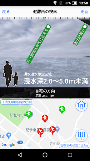
"Kihoku Town Disaster Prevention Navi" is the official app of Kihoku Town.Designated evacuation shelters and designated emergency evacuation shelters around your current location and details are displayed, and the AR camera function and evacuation compass function support evacuation behavior in the event of a disaster.In addition, hazard maps such as sediment-related disaster warning areas and inundation areas are also displayed, so you can check the danger of your current location.In addition, various disaster prevention information such as evacuation information and weather information will be pushed and delivered."Kihoku Town Disaster Prevention Navi" can be used not only in Kihoku Town but anywhere in Japan, and some functions can be used even when offline.[Main functions]・ Automatic search for designated evacuation shelters and designated emergency evacuation shelters around your current location・ Support for evacuation behavior from your current location to the above location・ Hazard map display of sediment-related disaster warning areas, inundation areas, etc.・ Display of active faults・ AR camera function, evacuation compass function・ Offline function, offline map download function・ Push notification of disaster prevention information・ Safety registration, safety confirmation
Secure & Private
Your data is protected with industry-leading security protocols.
24/7 Support
Our dedicated support team is always ready to help you.
Personalization
Customize the app to match your preferences and workflow.
See the 紀北町防災ナビ in Action


Get the App Today
Available for Android 8.0 and above